Cruising Lake Champlain
Shallow Water Sailors
24th Annual Magnum Opus Cruise
July 27th to August 9th, 2003
Lake Champlain, Vermont - New York
While the 2002 cruise is now water under the keel, the information on this page may be helpful in planning your own adventure.
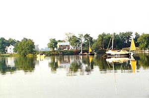
The twenty-fourth annual Magnum Opus Cruise will be held on Lake Champlain's Inland Sea. Located in the northern portion of the lake the Inland Sea is Lake Champlain's archipelago. The area offers wonderful gunkholing and is far from the madding crowd. Ed and Mary, Dovekie sailors and Vermont locals, have proposed a counterclockwise exploration of the Inland Sea. If you are unable to make the full two weeks, the area is well suited to a shorter cruise. The launch site is Apple Island Marina at the southern tip of South Hero Island on Vermont Route 2, by the Sandbar Causeway. The marina is part of Apple Island Resort which, in addition to the marina, includes a campground, cabins, and many amenities. Complete information about the facilities and driving directions can be found at the resort's web site, www.appleislandresort.com. The launch fee is $6.00 and $2.00 per day for parking after the launch day, this includes use of the campground showers.
History of the Magnum Opus Cruise.
Lake Champlain cruise information . . .
Apple
Island Marina Info
Charts & Cruising Guide
Useful Links
Recommended Charts . . .
There are three options for charts. The official NOAA charts (listed
below), waterproof NOAA reproductions, and chartbooks. For the MO cruise
you will need at least 14781 and 14782, possibly 14783. The NOAA charts
run about $17.00 each. The waterproof charts are slightly smaller and
include two NOAA charts, one on each side, these run about $22.00. The
chartbook atlas has it all for around $30.00, but it's chopped up into
11" x 17" pieces. It's a matter of personal preference, you
can learn more about the waterproof charts and chartbooks at the Lake
Champlain Publishing Company web site.
Prices for charts and guidebooks seems to vary from supplier to supplier.
These NOAA charts cover the entire lake.
Lake Champlain - Riviere Richelieu to South Hero Island Chart No. - 14781
1:40000
Lake Champlain - Cumberland Head to Four Brothers Island Chart No. - 14782
1:40000
Lake Champlain - Four Brothers Islands to Barber Point Chart No. - 14783
1:40000
Lake Champlain - Barber Point to Whitehall Chart No. - 14784 1:40000
Lake Champlain - Vermont - Burlington Harbor Chart No. - 14785 1:10000
Cruising Guide . . .
Having a cruising guide for Lake Champlain is optional and I am not
personally familiar with any. The following cruising guide seems to be
what everyone is selling.
Cruising Guide to the Hudson River, Lake Champlain, &
the St. Lawrence River
By Alan and Susan McKibben
272 pages
Over 400 photographs
8 1/2" x 11"
Spiral bound
Softcover
$36.95 from the Lake
Champlain Publishing Company web site.
Useful Links . . . .
HARBOR WATCH
Lake Champlain web site for boaters, includes virtual cruising guide.
www.harborwatch.com
LAKE CHAMPLAIN MARITIME MUSEUM
www.lcmm.org
FERRY SERVICE
www.ferries.com
WEATHER & WATER LEVEL INFO
National Weather Service, Burlington, Vermont office.
www.erh.noaa.gov/btv/
back to top